Ride 2019 Day 18
I knew it was going to be a long 82 mile day today, so I needed to get on the road early. Ellen made me a great breakfast, along with a PBJ sandwich for the road. I was going to need it because south of Half Moon Bay, there were not going to be places where I could get anything to eat or drink for almost 40 miles.

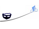
I was on the bike a little after 8 AM. It was slow going trying to get out of the city. It was not due to traffic. Until now, my routes typically had turns that were miles apart. When in doubt, I knew to take 101 south. Now, it was take CA 1 south. The GPS on my bike would only show a 2 to 4 block section on its display. In the city, I would often stop, take out my phone, and see if I was making a correct turn and see the bigger picture of the route. This process slowed me down. I needed to head west to the ocean and I was battling strong headwinds. It seemed like no matter what direction I was headed, I was going up hill. Some of the grades were ridiculous and I walked Hidalgo several blocks. At one point, I took a road that ran parallel to CA 1. I immediately regretted it as the road went up at a severe angle for at least a half mile. A woman who was also going to Santa Cruz made the turn at the same time. After pushing Hidalgo for 3 blocks, I finally started pedaling. The other woman who had chose to ride it was only 50 yards ahead. I hadn’t lost much time, but saved my energy for the long ride ahead. Between the hills, wind, fog, and route verifications, I travelled only 8.5 miles in 75 minutes, with only 55 of that on the bike. I had climbed over 600 feet in that time.

Once I started getting further out, I was on a paved bike path that eventually took me back to CA 1. Around Pacifica, the GPS looked like it had me on a bike path that ran adjacent to CA 1. I followed it into a neighborhood. When I stopped at an intersection to check a turn and see the big picture, an older man on a bike asked where I was headed. After telling him I was going to Santa Cruz, he said the path I was taking would not get me over the mountain I needed to cross. He said it would lead me to a horse trail 900 feet below the road above. When I saw the part of CA 1 that I needed to take, all I saw was a lot of traffic on a road with no shoulder, curving around a steep climb. The man said the only way to Santa Cruz was to take that road and pray. I’d been on some intimidating sections, but for the first time, I questioned whether I really wanted to do this. I looked on my phone and estimated the worst section would go about a mile. I marked the mileage on the GPS, dropped Hidalgo into his lowest gear and charged the uphill curve into the unknown. Because it really is me writing this, you know I survived! No sooner was I over that section, when I came to a half mile tunnel. It was foggy and could barely see the entrance. Fortunately, it had a shoulder that was as wide as another car lane.
I was eventually rewarded for my efforts. There were some nice overlooks and a bike path that led me down to a beach where there were many surfers in wet suits. I walked Hidalgo up a crazy switchback that took me more than a hundred feet up to CA 1.


From there I made it to the last place with anything to eat or drink. It was going to be almost 40 miles after leaving Half Moon Bay before I could resupply in Davenport. By this time, I had travelled 27 miles over 3 and half hours from when I had left my host. Not all that time was on the bike, but I have run a 26 mile marathon in faster times!


Luckily, things started to improve. The sun had broken out, I could put away the jacket, and I was starting to catch some tail wind. As I got to Davenport, I was holding long stretches of 18-20 mph, even with rolling hills. The difference was I didn’t have a hairpin turn at the bottom of the hills and I could build momentum to make the climb after a downhill. The wind was a huge help as well, getting stronger on up to the Santa Cruz county border.

Just after I crossed that county border I saw a magical sight. Tens of surfers were using air foils to pull themselves across the waves. In Davenport, I finally got to eat my PBJ. I added a tall glass of milk and ice cream to round it out.

I had let my hosts, Al and Linda Atlansky know that I was not going to get there before 6 PM because of my slow start. The tail wind had changed my under 10 mph pace for 3 hours into a 16+ mph over the next 2.5 hours of bike time. In the end, going through a city like Santa Cruz slowed me down with turns, checking directions and traffic lights. I arrived past 6:30. Details and the ride summary are here.

Al and Linda gave a great dinner, conversation, and a chance to do my laundry properly. Wonderful people and great hosts. What started off as a slow, treacherous ride ended on a happy note.
The Lone Rider

Leave a Reply